Booth Lake Trail – Near Vail, CO

Some people might say that waking up at 4am on a Saturday morning to go hiking is crazy, but I say it’s the only way to experience the best of some of the more popular trails in Colorado. That’s especially true when you get into the I-70 ski resort area of Breckenridge, Copper, Vail, etc., because most of the people hiking the popular trails are tourists staying at those resorts, and they don’t have a 2 hour drive!

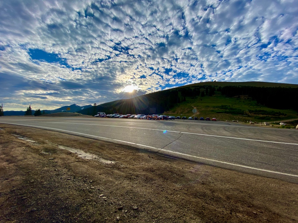
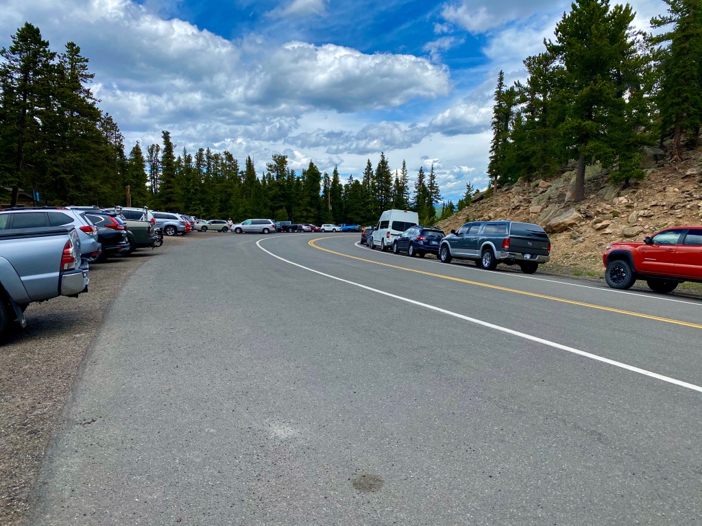
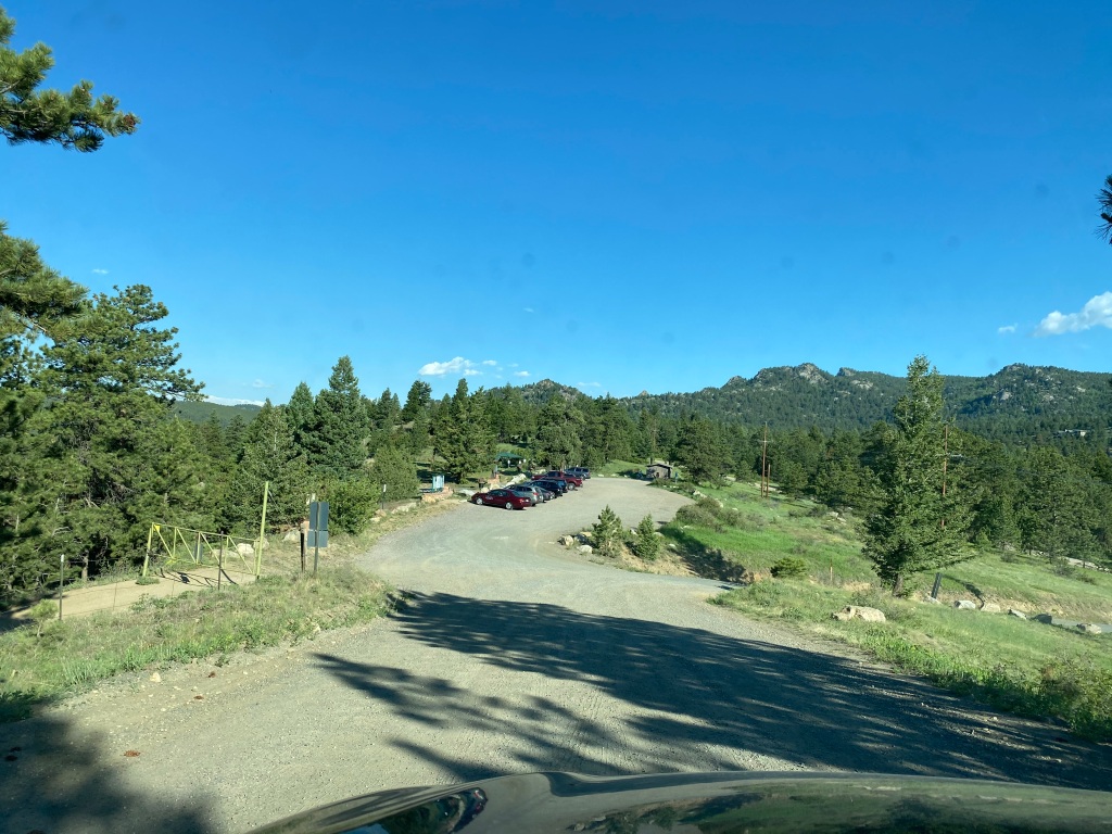
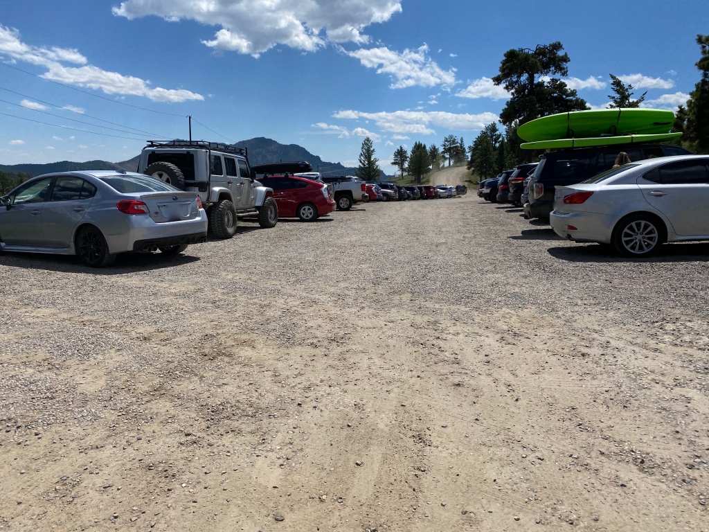
Eager to beat the masses, I packed up, headed out around 5, and arrived at the trailhead at 6:45 or so, met by about 8 cars. Because there is dispersed camping on the trail, at least a couple were surely campers from the night before still, but the parking lot is pretty small and I imagine it wasn’t too long after me that it was full. There was an overflow lot a little ways down the road, but that would just add more mileage to an already long hike.

Booth Lake Trailhead sign
Heavily wooded hiking trail

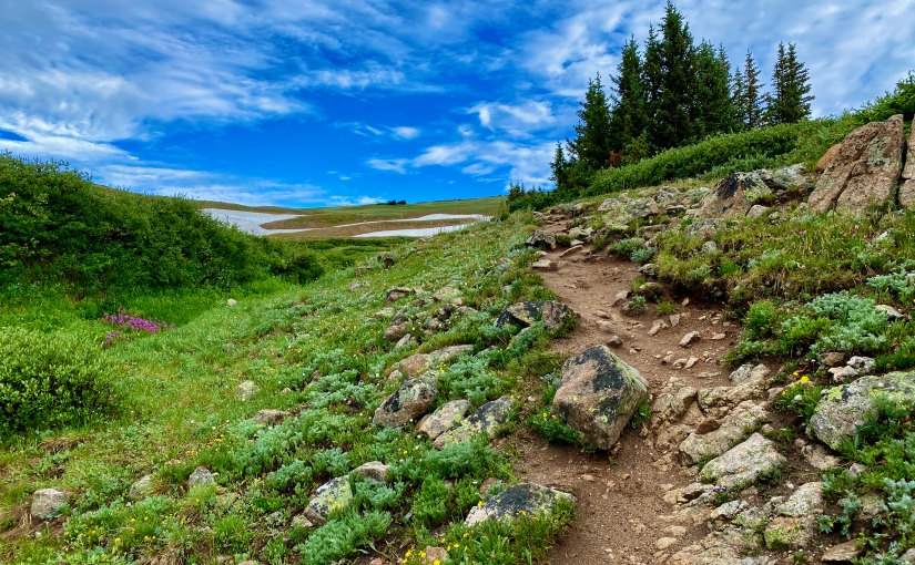
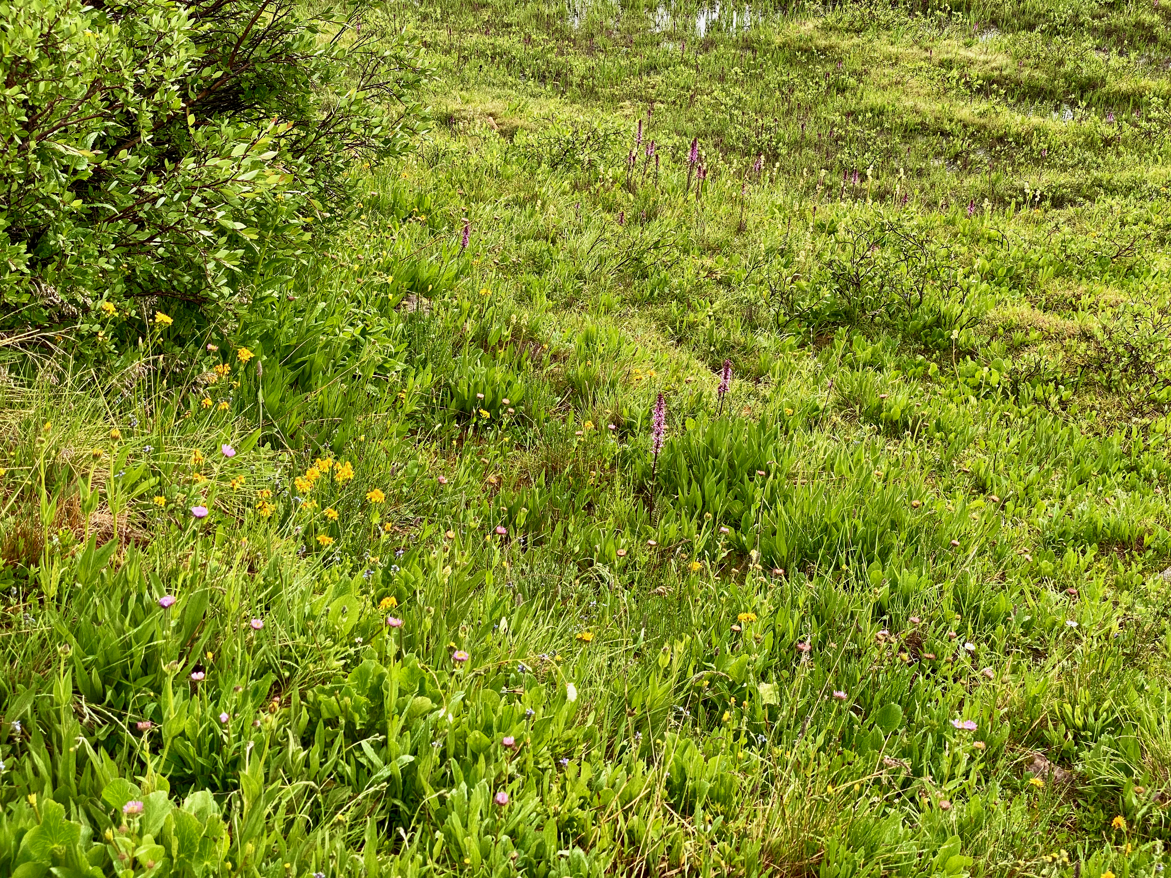
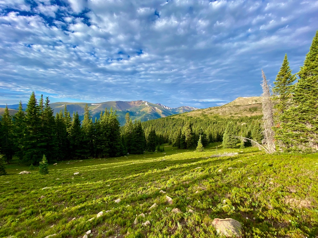
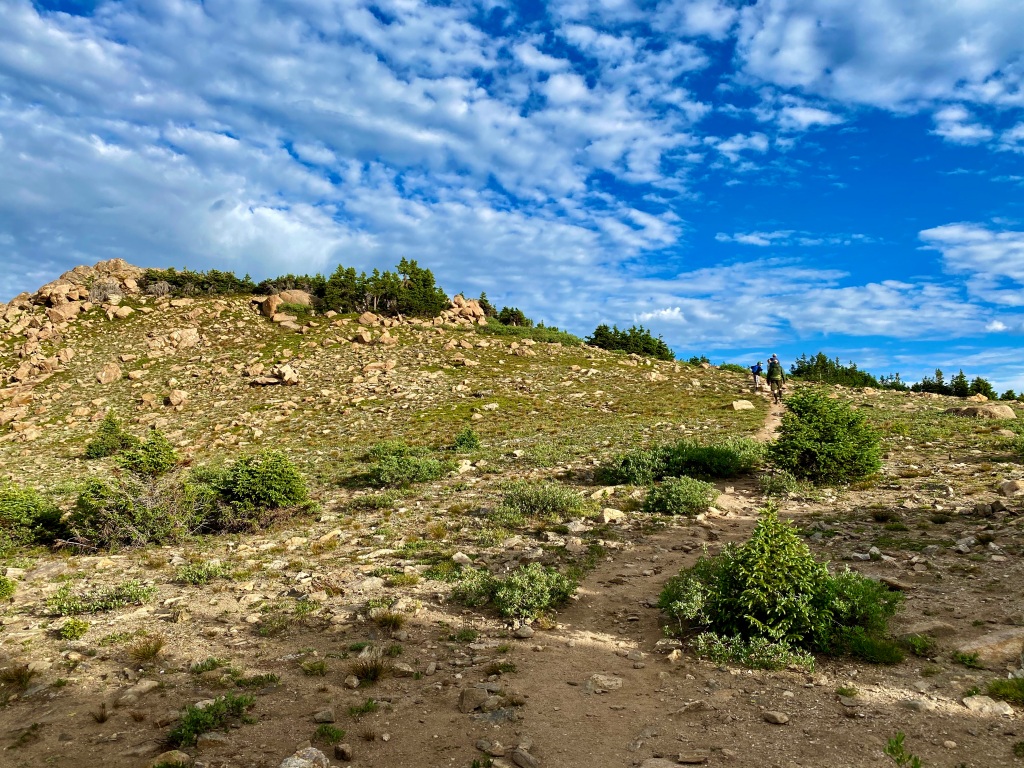
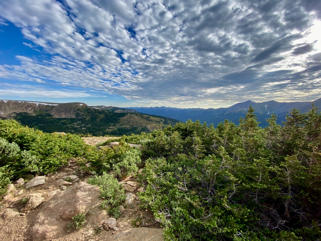
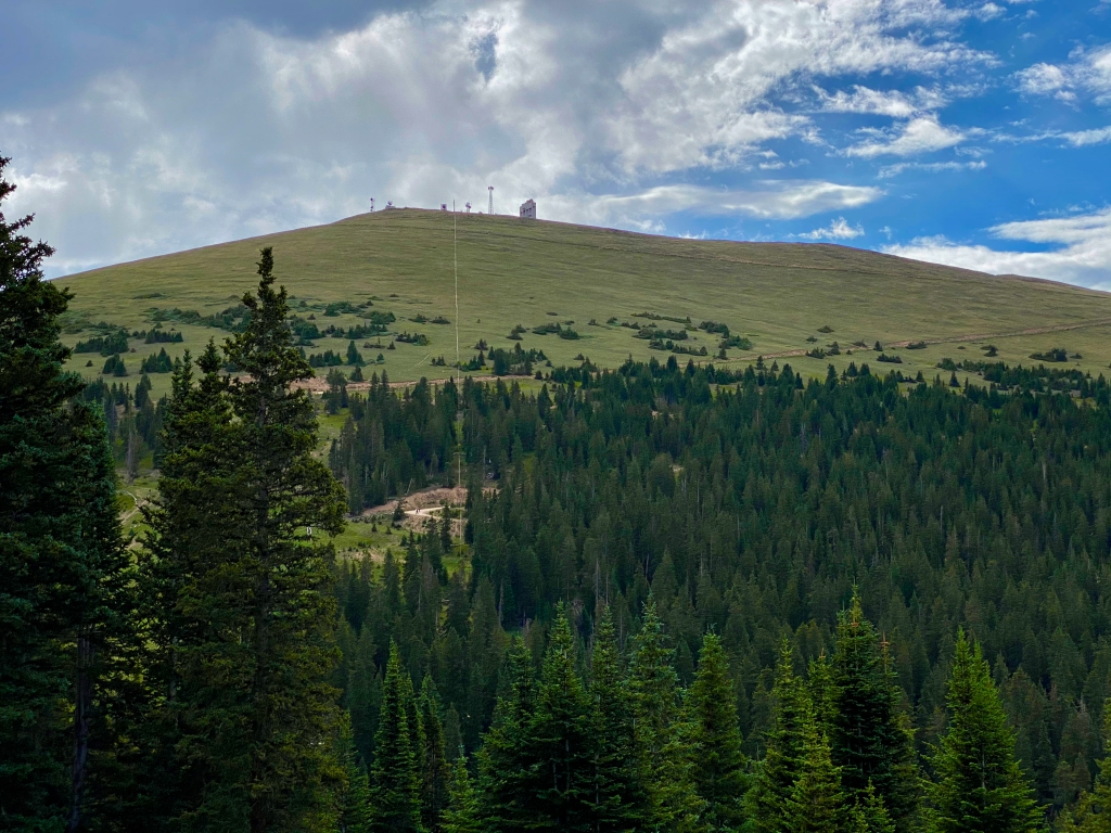
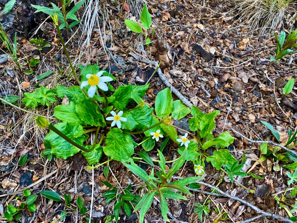
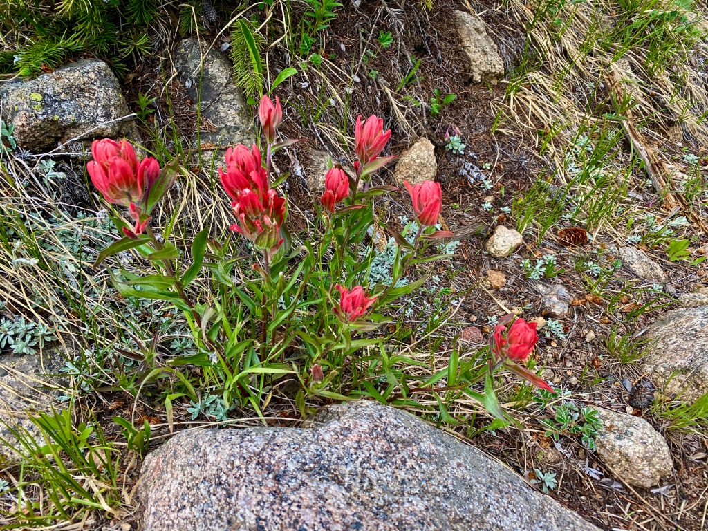
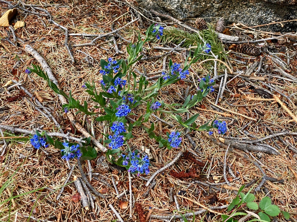
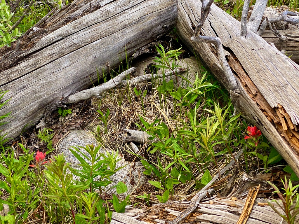
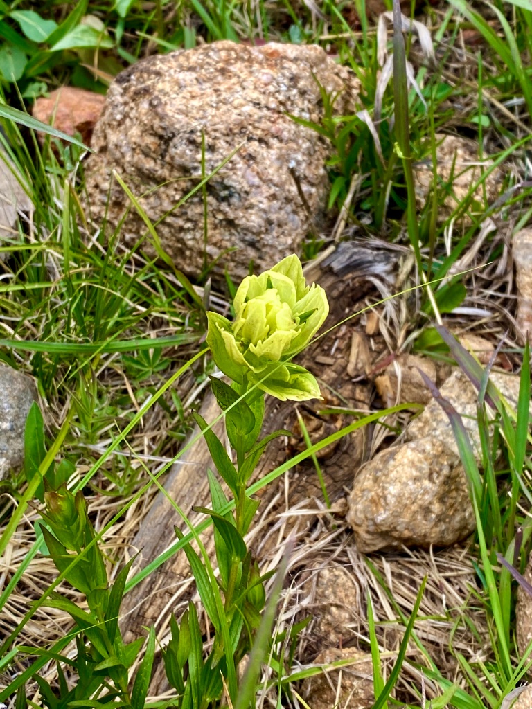
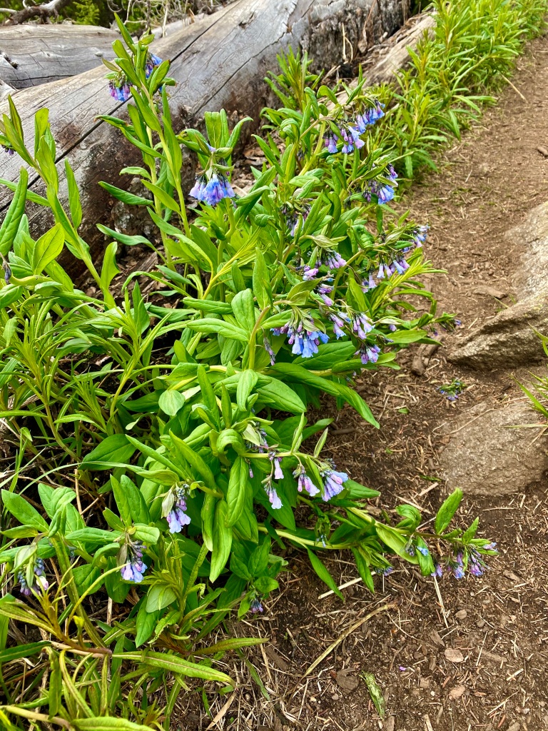
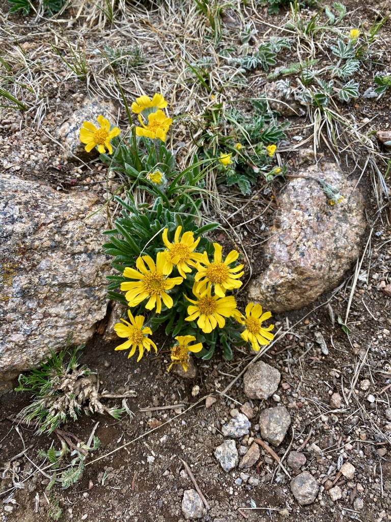
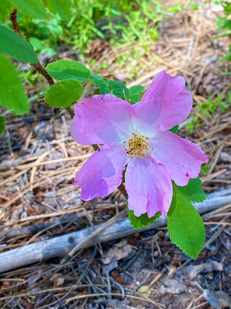
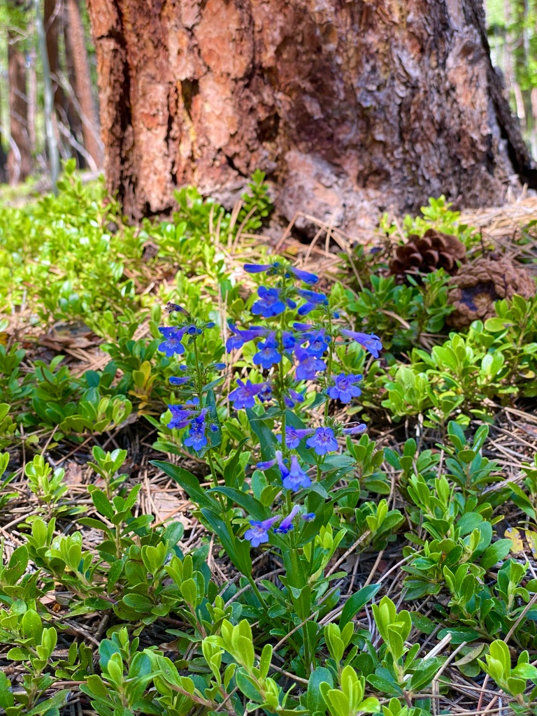
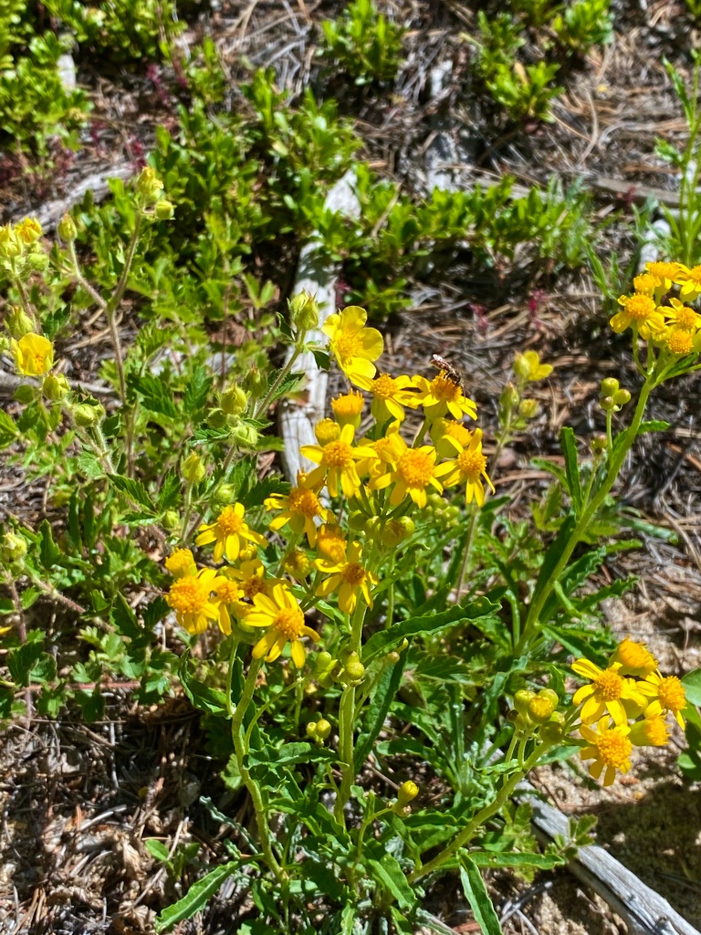
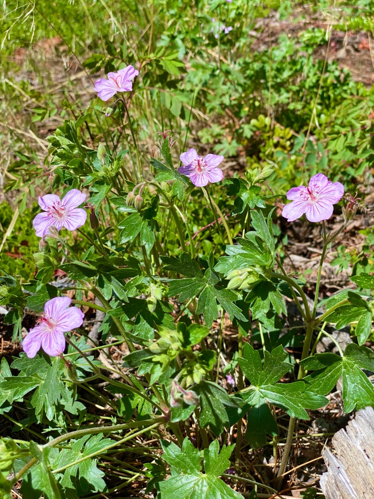
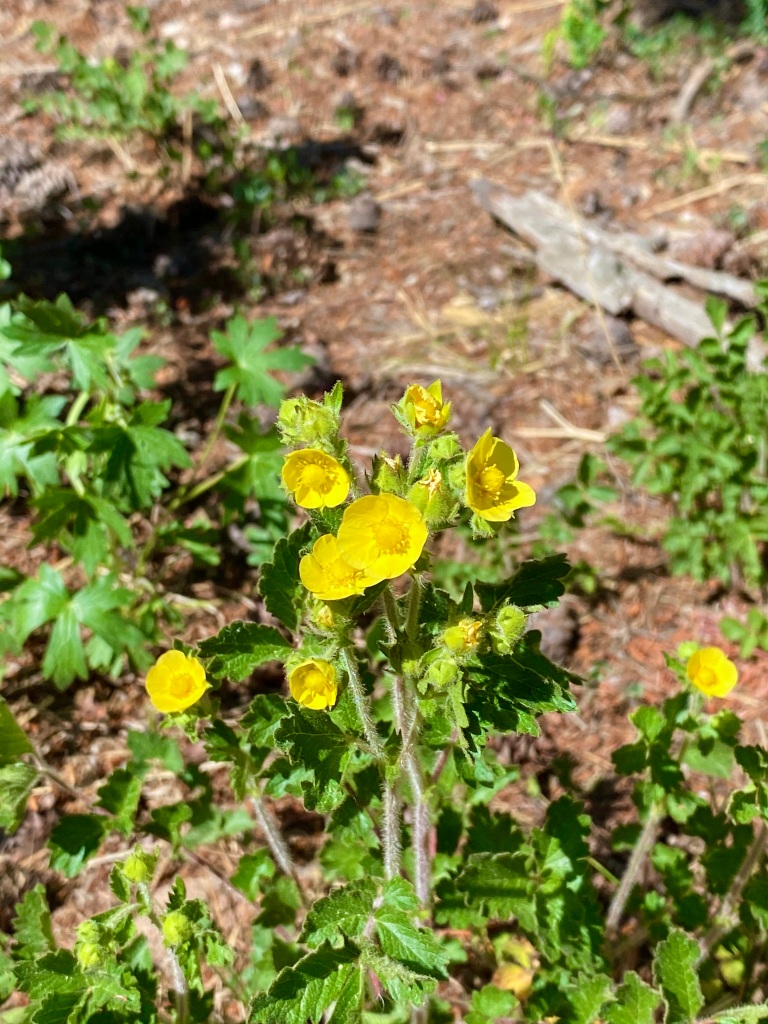
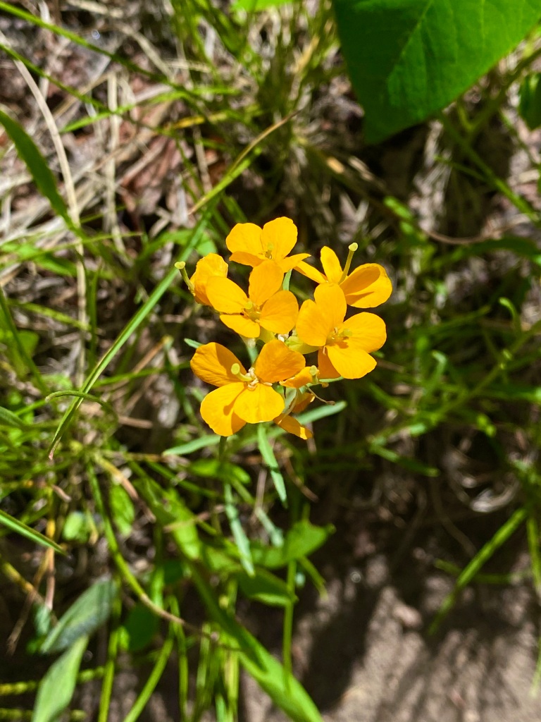
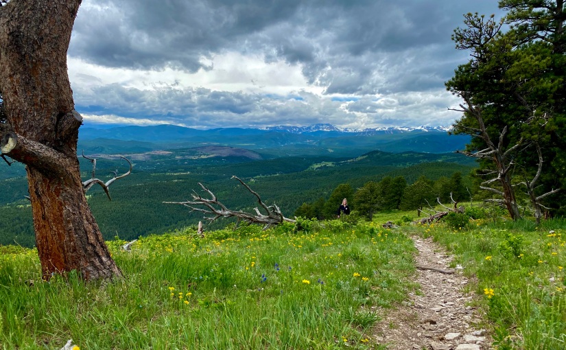
From the very beginning, the trail made sure I knew what kind of a day I was in for today. It started out steep, as if to say, “are you sure you want to do this?”. The first mile was brutal, climbing over 775 feet of elevation, which is pretty steep for me considering I use 500ft per mile as my benchmark of what I personally consider “steep”. My body wasn’t ready for this so early, but luckily for me, the forest around me was awakening with me and it was breathtaking, with the trail winding it’s way through groves of quaking aspens and more wildflowers than I’ve ever seen in my life.

Grove of aspen trees with greenery
Trail winding its way through aspen trees
Aspen trees with trail on left

I’ve thought some hikes we’ve been on had a lot of wildflowers, but this particular trail was in a different class altogether. You’ll have to forgive me, as I think I probably could’ve taken 1,000 pictures easily trying to capture the perfect shot of the flower-filled meadows.

Meadow trail entering pine tree forest
Mountain and cliffside covered in aspen trees
Wildflowers along the trail
Wildflowers covering a steep mountainside
Field of purple and yellow wildflowers surrounded by trees

I have to admit that my plan was to hike only to Booth Falls, a 4.2 mile round trip journey, but as the sound of rushing water grew louder and louder, I still couldn’t see Booth Falls. So I kept hiking, assuming that I would get my amazing view just around the next bend.

There were certain parts of the trail where you would come around a corner, and could only say “really?”

As the sound of rushing water turned to the trickling of a stream on my left, I knew that I had likely done something wrong. The hike up until this point has been one of my biggest challenges yet this summer, and I wasn’t about to go home without getting some sort of a payoff – though one could argue that all the wildflowers were payoff enough.

I liked to imagine that the gold color of the water was the gold lining the bottom instead of the sun’s reflection
My first sign of sun today!

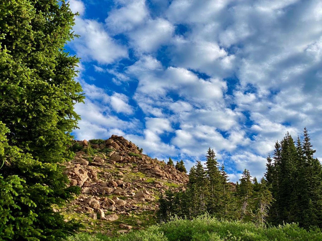
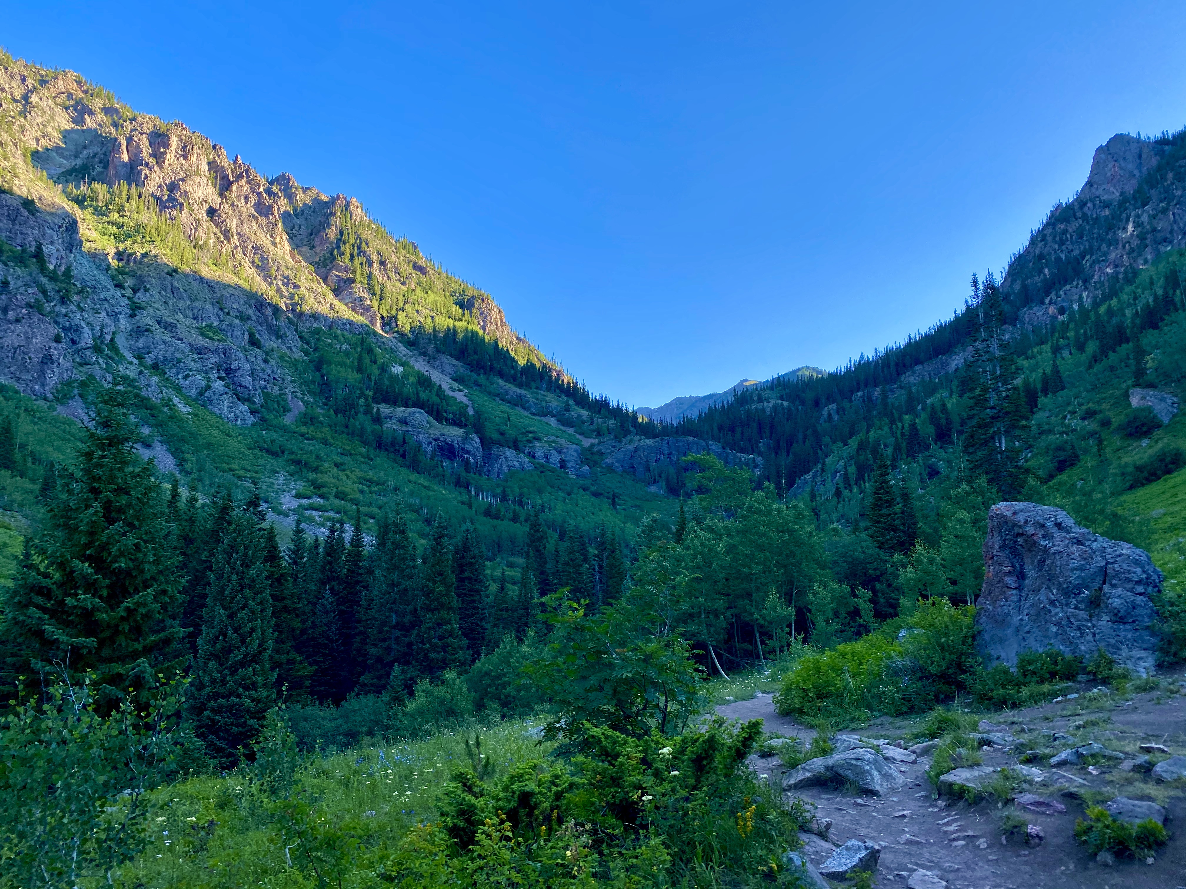
I’ve written before that sometimes I don’t know when to stop when I’m hiking by myself, and this turned into one of those days. The trail beyond where the falls were presumably at was unrelentingly steep, continuing upward constantly, with few flat areas to offer a break. I kept glancing nervously at my watch as the elevation passed 2,000 feet and kept going.

I thought this was so cool! Mother Nature at work, breaking down the tree to feed the new growth to come.

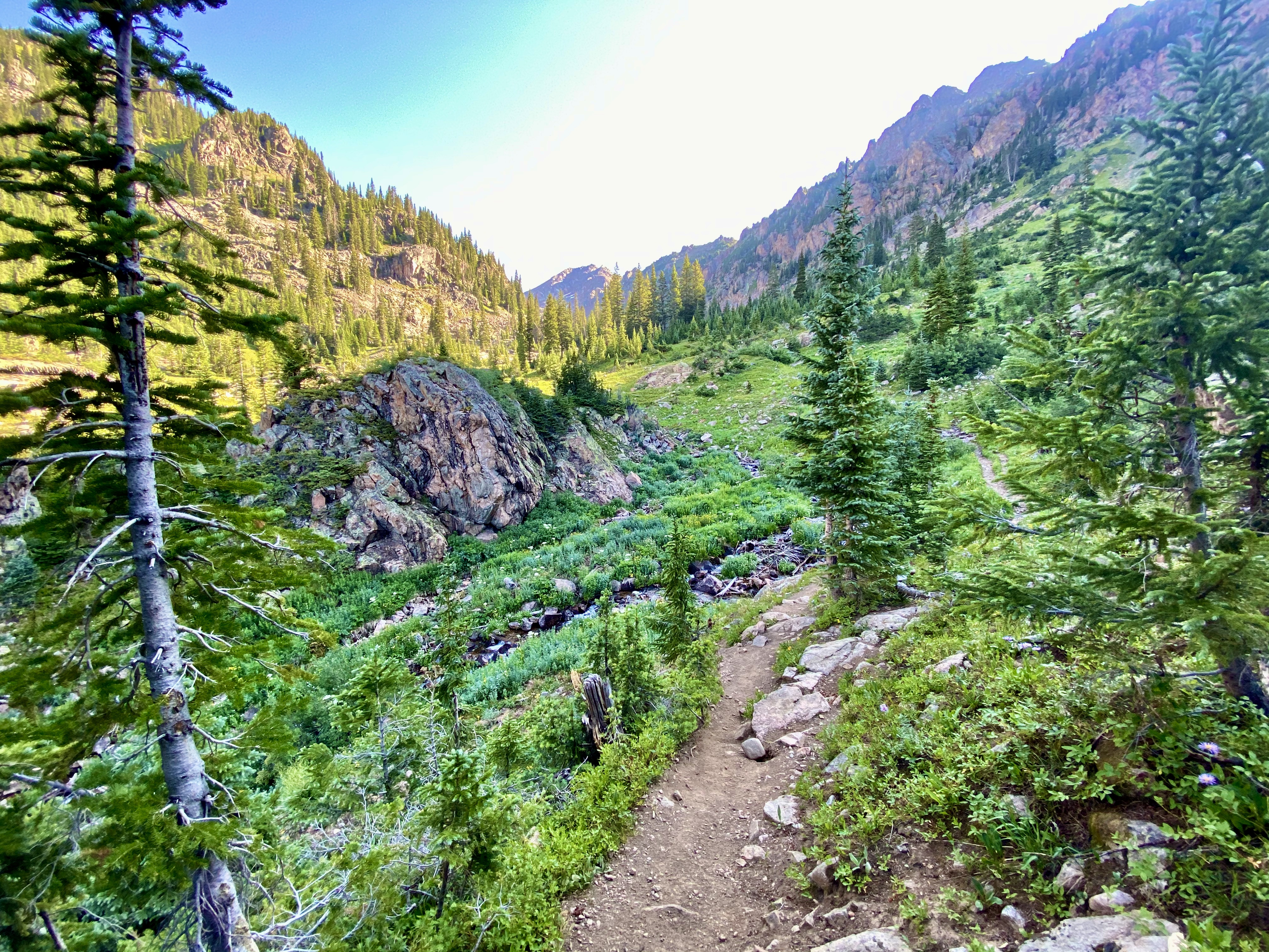
As the miles wore on and I passed 2,000 feet elevation gain, I started to wonder if this was a good idea. If it weren’t for the views and the wildflowers spurring me on to see what treasures might be around the next corner, I don’t know that I could’ve completed this, but it’s funny how the sense of adventure kicks in and I start ignoring what my brain is telling me.

Columbines are definitely my favorite wildflower – so I was really excited to come across this bunch!
More Columbines!

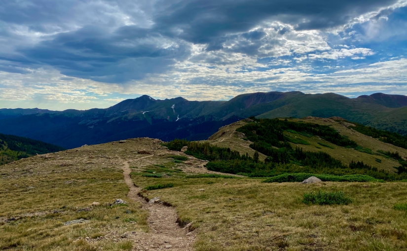
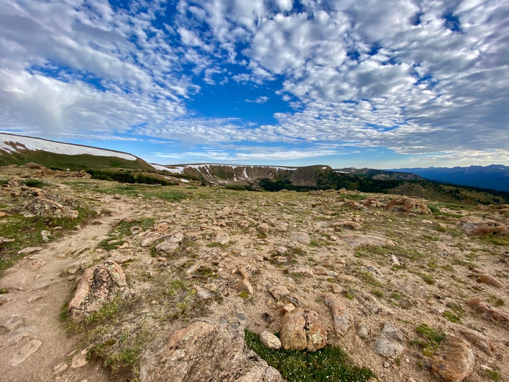
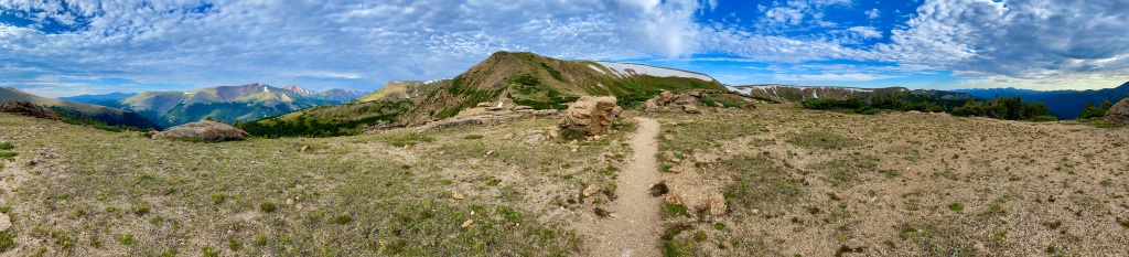
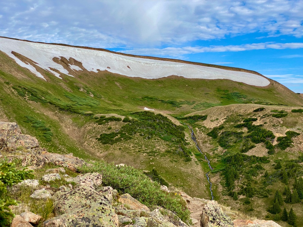
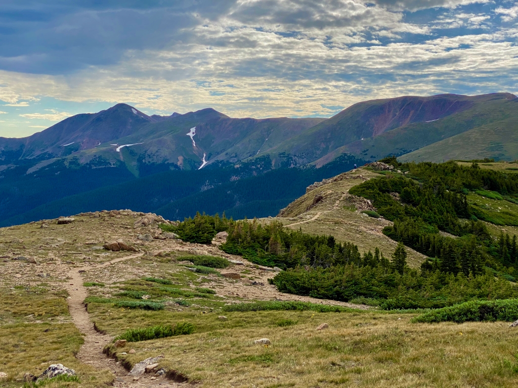
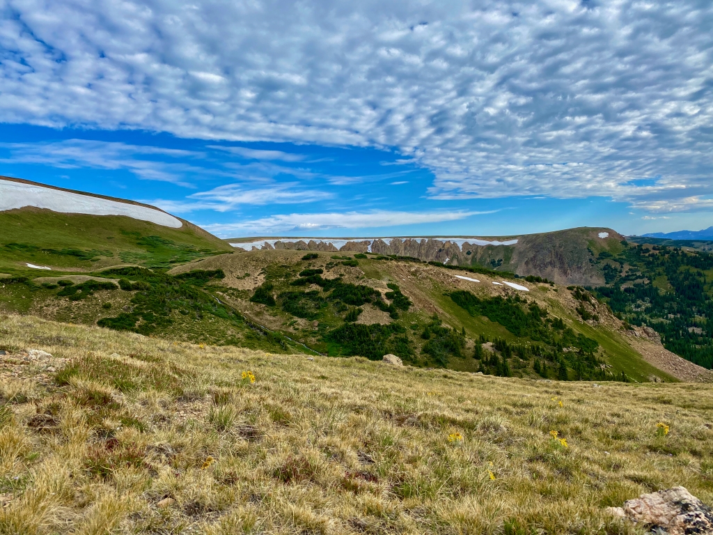
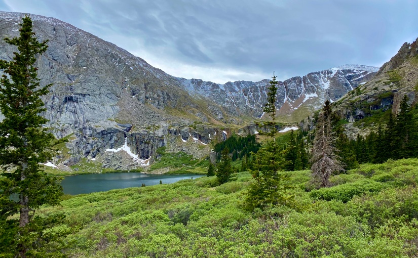
The last push to the lake is probably the most challenging section of the entire hike, so it’s a good thing that I emerged over the crest of the final ridge to a spectacular mountain lake vista. The sheer faces of the surrounding cliffs, carved out by years of snow and ice building up all winter and melting each spring, yielded to the crystal clear, ice cold lake. There were a few people dotting the shoreline and I made my way around to the other side of the lake where I could find a place to myself.

The water was so clear and so calm that it made for a magical experience.

I wasn’t in my spot along the lake for very long, when I noticed some commotion with the people that I had passed. I’ve been doing enough hikes lately to know that commotion like this, at such a peaceful mountain lake, could only mean one thing – wildlife. A review on AllTrails mentioned running into a herd of mountain goats, so that’s exactly where my thoughts went. I hopped up to see what was going on.

Sure enough, I was looking at the first mountain goats I’ve ever seen – though they were quite a ways up on the ridge. As I stood there and watched in amazement, more and more of them emerged, with eventually 10-15 or so coming into view. They made their way down the mountainside towards us curious humans, searching for the perfect plant to snack on in the cracks of the rocks. The closer they came, the more I realized just how large mountain goats actually are – and also how large and pointy their horns are. They didn’t seem to really care about the humans taking pictures, but when one seemed to find a plant that they all craved, little skirmishes would break out within the herd, as they would charge at one another for a chance to eat first. Whenever the big one would look you in the eye though, it made you think twice about how close you were.

Soon, they had come down the mountain so far that they were blocking the trail back. I made my way around them, keeping my eye on the big ones that were keeping their eye on me, making sure that I gave them as much space as they wanted. I took this incredible opportunity so close to these animals to take as many pictures as I could. Much like it was when I had my moose encounter on the Chicago Lakes Trail, it was almost impossible to pull myself away from the mountain goats and start down the trail. I wanted to cherish it for as long as I could, but extending my hike to the lake had already added a lot of time to my journey.

It was so hard to pull myself away from the lake, especially after the effort to get there, so I perched on top of a rock overlooking the lake to snap a few more pictures and take in the beauty for a few more moments before heading out.

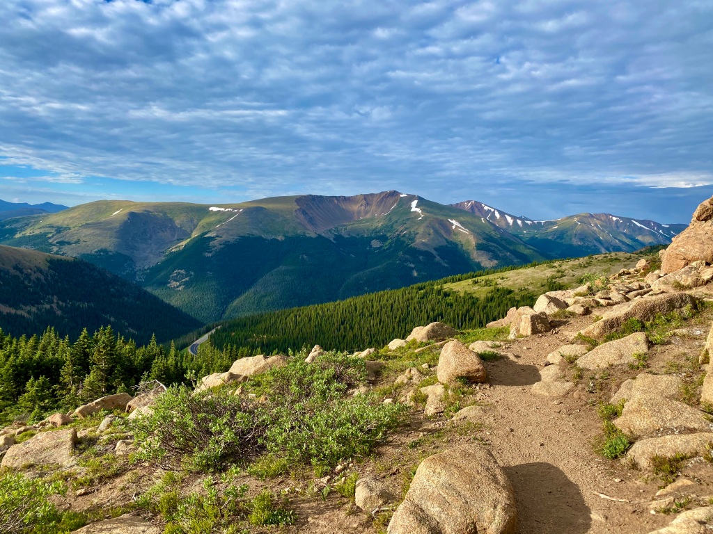
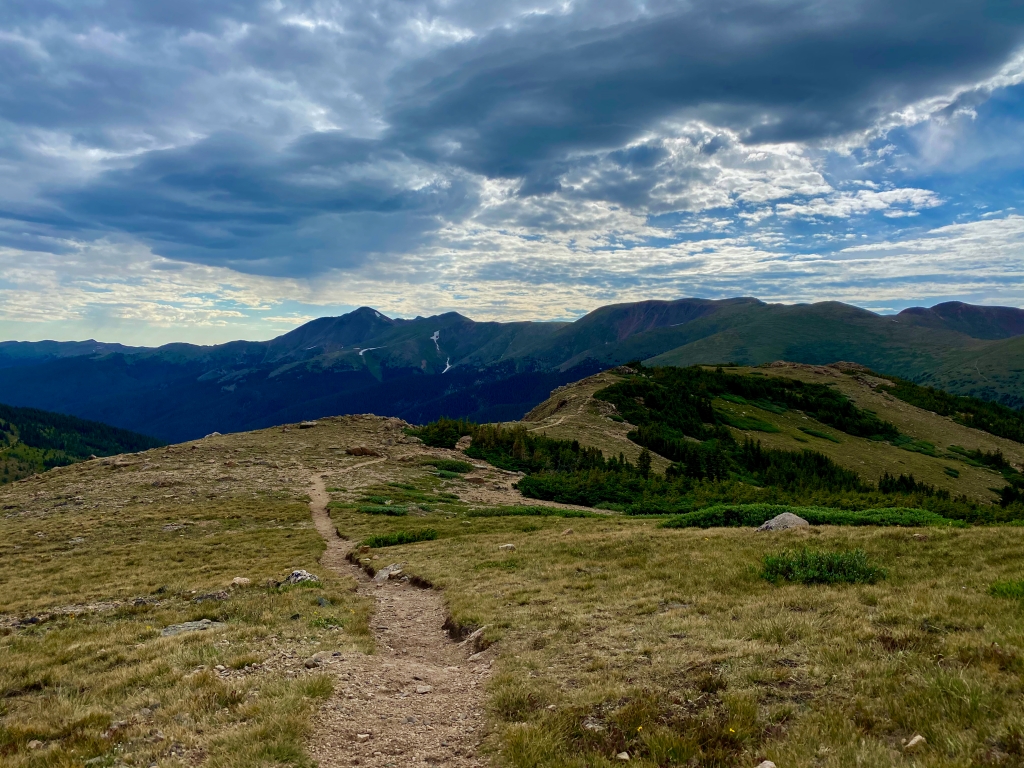
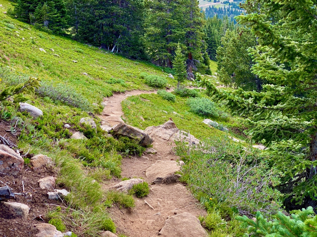
On the way up to the lake, I was very aware that I was climbing a pretty serious incline from how hard I was breathing and how much my legs were burning, but when I started to go back down, there were some parts that I couldn’t believe I had made it up. The trail was rocky, which helped with the traction going down such steep sections, but the constant decline was exhausting. When I did reach one of the few flat parts, not having to fight the pull of gravity almost made me feel like I was floating for a brief moment, before starting back downwards once again.

Down and down and down I go….

I passed a lot of groups on my way down, and it was yet another reminder of why I wake up so early to do these hikes. There were a couple hours on the way up that I didn’t see another person, and it allowed me to take my time to enjoy the beauty of this majestic trail. I chuckled to myself every time I passed people that were clearly not prepared for such a grueling hike, clutching empty water bottles with miles left, and wonder if they were going to actually make it all the way to the lake. I think this hike challenged where the limits to my physical abilities were and I’ve been consistently hiking for the last few months now. I can’t imagine trying it while visiting from out of town, as so many of the people seemed to be.

On my way back down, I did my best to search for Booth Falls, and it did seem to be close to where I thought it was based on the congregation of people in that area; however, I never did actually get a good view of it. I think there must be a turn off the trail that I missed both times, so I’m glad I didn’t turn around earlier searching for it, and instead conserved energy for the push to Booth Lake.

I had to do some serious searching to even get this shot…

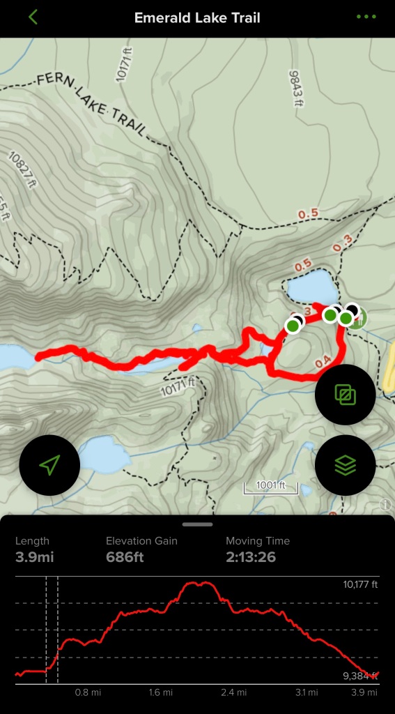
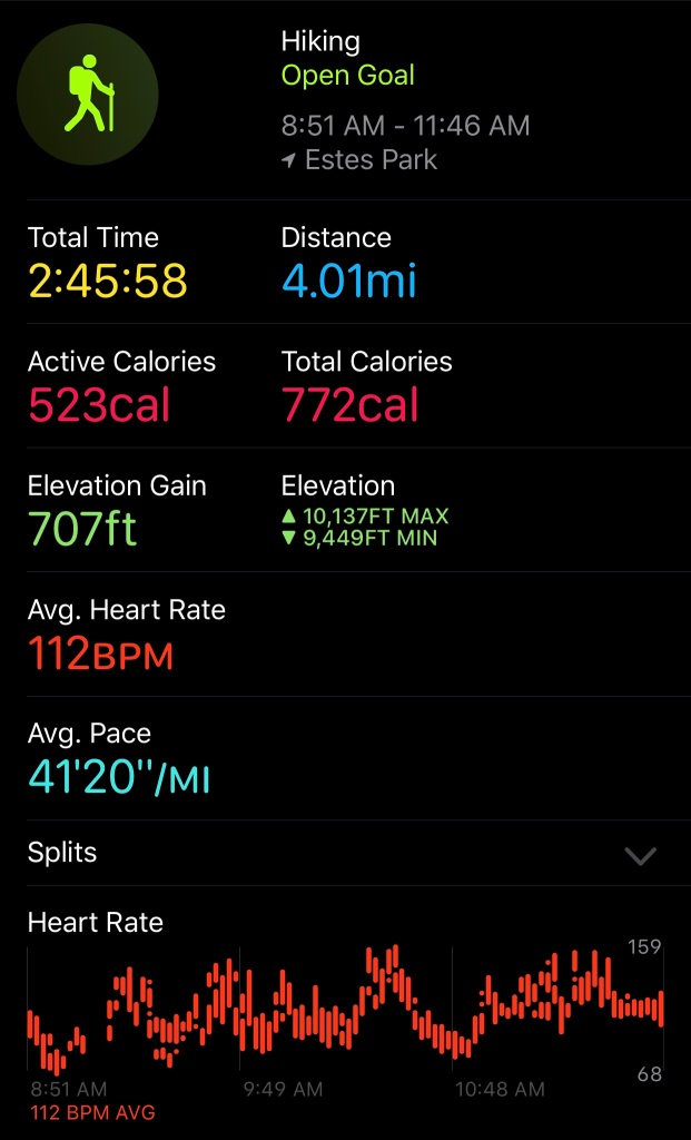
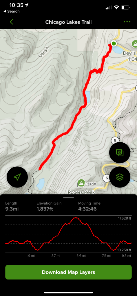
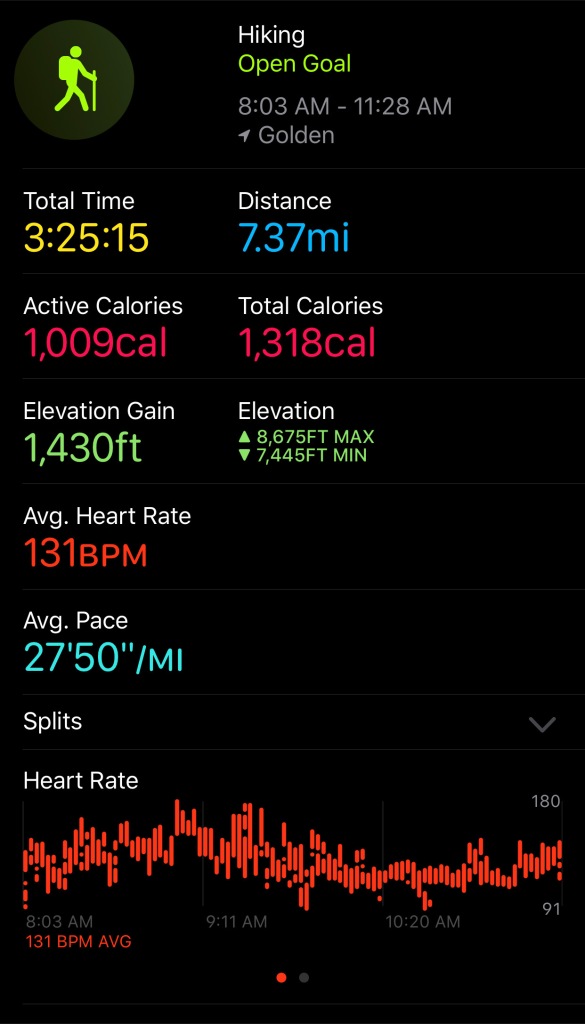
At 10.5 miles and 3,100 feet of elevation gain, this trail isn’t for everyone, but the abundant wildflowers, waterfalls, streams, views, mountain lake, and wildlife catapulted it to be one of my favorite hikes I’ve done! I can’t wait to explore more of this area and see what other treasures it has to offer!

Hiking the Second Creek Trail to Twin Cones

My hike Sunday and this post are dedicated to my Grandma Branch that passed away on Friday. When I was little, I used to write one or two page stories for her to read, and almost every time I talked to her growing up, she would bring them up and how much she enjoyed them. I started writing about my hikes again in large part because I wanted her to be able to read these stories and stay up to date with what I was doing. I’m sure every time I write from now on, I’ll be thinking of her.

I was either really excited for this hike or I’m starting to get the hang of this early morning hiking thing, because I woke up at 4am, left around 5am, and arrived at the trailhead by 6:30 Sunday morning. There were 3 or 4 others cars in the parking lot already, but one of them looked like he was packing up to leave from camping there the night before. With the archway of trees that was the trailhead leading me into a magically lush forest, I was looking forward to the upcoming hike in solitude.

If the two cups of coffee this morning weren’t enough to wake me up, the first mile of this hike certainly was. The first quarter mile or so was peaceful, with the stream on my left babbling a morning melody as I made my way along the damp trail.

It rained the night before, which actually turned out to be quite the benefit once it started to turn steep. What would typically be loose gravel and dirt on a steep path was packed down and offered much more grip. From the quarter mile mark to three quarters of a mile was a fight. The humidity in the air combined with the elevation made it hard to breathe, and I was sweating despite the 40 degree temperatures.

Once I reached Broome Hut, I took the opportunity to admire the beauty of the morning sun rising over the valley surrounding me, sparkles of light touching the pine needles holding onto the rain droplets from the night before. Let’s be honest… I also took the opportunity to let my heart rate come back to a normal level and catch my breath, but the views were incredible.

Maybe I was warmed up or maybe it was just a tiny bit flatter, but after Broome Hut, it definitely seemed like it was easier. I was greeted by another mountain stream on my right, cascading it’s way down the canyon to lower elevations. The freshly melted snow gave life to the wildflowers growing on the banks of the stream. They would be my companions as I pushed my way higher and higher, never leaving my side.

That is, they never left my side until I reached their source. The snow fields were still intact and I joked to myself that the water pooled at the bottom of them was my alpine lake for the day. I was approaching 12,000 feet elevation by this point, and it was time for another push to the top. The challenge in this steep section was the thin air. There was one section where I stopped two or three times, just to try to catch my breath.

Once I made it to the top, I was presented with a magnificent plateau-like feature, where the land stretched out around me was flat – at least as flat as it gets at the top of a mountain. Because it was so flat, I could see for the mountains surrounding me for miles and miles on every single side. There’s no way that the pictures will ever do it justice, but I’m certainly going to let them try.

I continued on this flat part of the trail, content with the exercise I had already received to enjoy this peaceful stroll. The wind was oddly quiet today for being above the tree line. I could hear birds chirping and the streams below rumbling. In the distance, I spotted a hot air balloon below me, floating along uninterrupted in the neighboring valley until it disappeared into the clouds. Remind me to never get on a hot air balloon.

If you look REALLLLLLY close, you can see the hot air balloon in the white clouds below me.

The trail continues onward, gradually becoming more and more faint, until it disappears altogether. I saw one other person on my way up, but he took a different route when he reached the mesa, so I was by myself at the end of the road so to speak. I was almost eye-to-eye with a ski lift on the neighboring peak. After some research, that is the Parsenn Bowl at Winter Park – I’ll have to try to remember that if I ever find myself at the top of Winter Park snowboarding.

I found a nearby rock to sit on, taking this opportunity at solitude afforded to me to reflect on the past couple of days. As I sat there and the clouds swirled all around me, I was hit by an overwhelming feeling that I was about as close to heaven as I could get. It was surreal and powerful at the same time. I decided I should take this opportunity to send up a prayer to my grandma, and tell her all the things that I wish I could and all the ways that I’ll remember her. It will never be the same, the way the clouds were this morning as I sat there all by myself, but I think this will be a hike that I’ll come back and do when I’m missing her in the future. For me, the place where I was sitting will always be tied to the memory of this moment, where I felt like I could talk to her one last time.

I spent about 20 minutes by myself before I could see the next group of people meandering their way down the trail towards me. I took in the scene around me one more time, and it was time to head back down and let them enjoy this perfect place for themselves. As I worked my way back down, the clouds started to put on a show. It started with one column reaching upwards from the ground well below me.

Smallest alpine lake ever. Or is that considered an alpine puddle?
The trickling start of a creek that will eventually feed and build into a major river.
The wildflowers didn’t disappoint today!
Can you spot the chipmunk amongst all the flowers?!

As I kept going, I stopped several times, marveling as the clouds crept ever closer, gently, as if to ask permission before enveloping me. I pressed onward letting the clouds know it was okay, and for a brief moment, I was completely surrounded. The closest comparison is flying through a cloud when you’re in an airplane, and it was like that, the way the sun was blocked out, but you could also feel the difference. I could suddenly see my breath as it turned to water vapor. It’s hard to describe, but it was an incredible experience. Almost as if heaven recognized my efforts to get as close as I could, and had come the rest of the way down to let me and my grandma be together one more time.

As hard as I’ve tried to put it into words, it’s impossible to describe how much this hike meant to me today. It’s a memory that I’ll always remember and hold onto. One more memory in a long list of many when I reflect on how much my grandma meant to me. I love you and I miss you!

Stanley Mountain Trail – Berthoud Pass

Waking up early and heading to the mountains for a morning hike has been my escape of choice over the last couple of months. There’s something about breathing the cool mountain air and getting some exercise that brings about a feeling of freedom and accomplishment to my weekends. I think that’s what keeps bringing me back. I think that’s also what pushed me to get back out on Sunday this weekend, after our hike to St. Mary’s Glacier on Saturday, even though I was feeling a little bit tired. I woke up really early without planning on it and decided that I was going to get up and feel some accomplishment this morning.

We’ve made the drive to Grand Lake numerous times, going up and over Berthoud Pass on the way. The first few times I made the drive, I was so nervous going around the bend that I was just happy to be going back down the other side. The last few times, though, I’ve noticed the parking lot at the top and the trail that people were hiking up, and thought to myself that looked like fun.

I arrived right around 7am and there was still plenty of parking. It wasn’t because there weren’t any other cars, but the parking lot was actually quite a bit bigger than I had envisioned driving around the curve and past it so many times before. I also hadn’t ever noticed the building there, which turned out to be a “warming hut” – presumably for back country skiers in the winter. It also had clean bathrooms – another plus at the trailhead.

Most people seemed to be heading up the Mount Flora trail that was directly connected to the parking lot, but I was interested in the Stanley Mountain trail that required me to jog across the street, hoping that nobody came around the corner too fast.

The trail began as a fairly steep incline through the trees, with some meadows filled with wildflowers sprinkled in. The wildflowers were one of the best parts of this hike because they were so plentiful, and seemed to mix in intriguing colors and patterns. The trail also offered views of the surrounding peaks and glimpses of the destination as you worked your way up. I’ll let the millions of pictures I took do the talking!

When you emerge above the tree line, that’s when the views of the taller peaks further to the north emerge.

A little bit further up the trail and a little higher still, you come to a fairly flat saddle with 360 degree views of the mountains and the trail up ahead. It’s one of the most breathtaking views I’ve seen here in this state. Although this split view is south on the left and north on the right, it still felt a little like I was on the continental divide.

It was when I reached a point where you had to briefly make your way along a cliffside that I realized maybe I wasn’t quite as committed and determined as I should be today. I turned around the first time I reached this spot, content to call it a day, but I talked myself up and decided to dip my toe into the uncomfortable to see what was on the other side. I could see that the stretch along the cliff wasn’t very long and the trail was decently wide for most of it, so I went for it. I’m sure it wasn’t something that most people would think twice about, but it was big for me this day. I walked a little further, to try to get a better view of the small mountain stream cascading down from the melting snowfield.

I love the mountain stream starting from the snowfield. As always, it’s hard to tell when there’s a cliff, but this is where I turned around the first time.

It was in plain sight the entire time I had been on the saddle, but when I started up the steep series of switchbacks heading to the next ridge, that’s when I decided this wasn’t my day.

I promise I made it to the second switchback before turning around. This was just the best picture I took of the incline.

The trail from here was steep, with loose rocks and dirt, but it wasn’t really my fear of heights that took over this time. I think I simply realized that maybe I had pushed it too far and I wasn’t up to doing two hikes in one weekend, even if neither one of them was particularly long or challenging. My knees and ankles were hurting and I didn’t want to head up even further. I’ll admit that I was beating myself up a little over the fact that I didn’t have the desire to finish the hike, but I sat down, taking in the views around me, and had an epiphany. This was my lesson today. I was sitting at over 12,000 feet on top of a mountain, taking in one of the most incredible views I’d ever seen, and it was okay to be content with what I had accomplished. I absolutely will be back to finish this on a day that I’m feeling up to the task because it did challenge my fear of heights at times – something that I need to expand the possible peaks I can tackle in the future. That day just wasn’t today.

The view as I was sitting down looking back down the trail that I had just crossed. This was good enough for me today.
You can kind of see the cliff on the left side of the trail
I never got a better view of the mountain stream the further up I went, but at least you can tell I climbed higher than the point where I turned around the first time!

I headed back down, appreciating the wildflowers and the birds chirping. I kept my eye out for moose or deer, never seeing any, but I was still oddly content with my journey today. I plan on taking the week to rest up and making the most of one day of hiking next weekend.

A bit of an inside joke between Carly and I, but couldn’t believe I came across half of a “butt tree”
Looking up at the Mount Flora trail. I definitely plan on tackling that one someday too.
View of the parking lot as I came down at 9am. The lot is big, and I think most people just stay to get pictures of the sign at the top and leave, such that parking didn’t seem to be an issue, despite being nearly full.
Pocket of rain moving in. Glad that didn’t hit me when I was up on the saddle!

Expedition to Emerald Lake

During my parents visit over the Fourth of July weekend, the plan was for us to visit the main part of Rocky Mountain National Park that my mom, despite her many trips to Colorado already, had not visited. Unfortunately, we realized too late that you needed a reservation for a timed entry, due to COVID, and we hadn’t planned ahead for that. Our only option at that point was to wait until Friday morning, when we could try to secure a spot at the park for Sunday; however, we knew the day after the 4th of July was going to be insane trying to get back to Denver after our day at the park. So while we did briefly wander into RMNP last weekend, we didn’t reach the part of the park that my mom was really wanting to explore.

After all the research and anticipation last week, though, Carly and I decided that we were going to go try out the trail that we had intended to do the week before. We already picked out the trail to Emerald Lake and we had enough time to get our reservation at the park this week. The reservations are in 2 hour increments, starting at 6am, and since we had a 2 hour drive to get there, we decided 8am was the earliest we were going to make it. We packed up our gear the night before, so that we could get an early start and make it right at the beginning of our two hour window.

We arrived to the entrance of the park around 7:50am, just before our timed entry, and we were greeted with a line of 20-30 cars on the side of the road that were clearly also waiting for 8am. We pulled off to the side and got in “line”, though I put it in quotes because it was far from orderly. There were only 65 reservations available at 6am and it felt like we were pretty close to the front of the line for the 8am reservation; however, upon entering the park, we were directed to the park and ride because the Bear Lake parking lot was already full! I certainly had hoped to avoid any situations where I’m packed in an enclosed bus with the pandemic going on, but it was looking like today that wasn’t going to be possible. We parked at the park and ride, waited about 10 minutes for the bus to arrive, and then made our way to the Bear Lake trailhead. As we got there, the parking lot was indeed full, and my only assumption is that most of the 65 people at 6am had wanted to come here.

I’m clearly still trying to figure out how to wear this thing…

We quickly realized that, despite this being the third most popular national park in the country, it was still really easy to get off the trail that you intended to be on. It took us a couple different restarts before we were finally on our way up the trail. It did allow us to take a few pictures around Bear Lake, so it wasn’t a total loss that we couldn’t figure out where to go.

Throwback to us standing out in the middle of a frozen Bear Lake!
I don’t think I’m going to be able to stand on it today…

We actually didn’t follow the sign with the arrow pointing to Emerald Lake that had numerous people heading up, but instead took a side shoot off the Bear Lake Trail to Nymph Lake. It proved to be much more difficult terrain, but I didn’t mind, and it helped us to avoid the masses moving up the other way.

We went right instead of left, walking along the Bear Lake Trail for a little bit, until we reached trail marker 30

It was a quick hike to Nymph Lake, even taking the more rocky path that we took, and we quickly realized the type of day that we were in for. Looking across Nymph Lake at the yellow water lilies perched on top of the water, with their stems visibly reaching down through the clear water to the bottom, the family of ducks gliding gracefully across the lake, and the imposing peaks standing behind it all, it was a serene location that you don’t often come across. This is why this place was designated as a national park and this is why this place is so popular. It was breathtaking.

Family of ducks without a care in the world.. I mean, look at where their home is!

I honestly think we could’ve spent all day at Nymph Lake, but soon the crowds came to push us along further down the path, and we had to peel ourselves away from this precious place. This was another time that we were glad that we had the AllTrails map downloaded because it took a little bit of searching to find the trail to Dream Lake.

Wait… is this the trail?

This section of the hike was probably the most challenging, with a couple of different spots where we had to wait for people to get up a steep part of the trail or stop to take pictures. The challenge was rewarding, with the many different sights to take in, but this is when I started to think we should’ve found a way to make the 6am window work. Imagining being here with less than half the people around made me want to come back even more.

Even looking at this picture now, it doesn’t seem real!
Carly found a side trail to go get a closer glimpse of this waterfall and wildflowers!
Waterfall from up above. There were too many people around it to get a better shot from below!

We eventually made it to Dream Lake, which is the largest of the 3 lakes that we would be visiting on our journey. The trail follows along the edge of the lake, and we took every opportunity we could to go down to the water and check it out.

We were greeted by a couple of rainbow trout at the first spot that we stopped at, and they were kind enough to come close enough for me to take some pictures and videos of them. Even though the fishing is catch and release, I tried to keep my two new friends secret from the fly fishermen walking by searching for a spot to drop their line.

The water is so crystal clear that it doesn’t even look like it’s there!

As was so often the case on this hike, it was truly hard to make yourself keep moving to the next location because of everything there was to see and explore, but knowing that the 10 o’clock group would be hot on our heels was the motivation to reach Emerald Lake before they did.

The route from Dream Lake to Emerald Lake followed a similar pattern from the earlier portions of the hike, with a steady incline, some stair like features, but overall not that much of a challenge for those that are looking to reach the last lake on this leg. There were no steep drop-offs or sketchy river crossings, but the trail certainly wasn’t boring. I really enjoyed this part of the hike and being forced to explore a little to make sure that you’re on the trail still. I actually prefer this to the way-too-defined trails that I follow sometimes, I guess because it makes me feel like I’m in the wilderness just a little bit more.

When we arrived at Emerald Lake, there were several groups that had beat us there and had already staked out their spots. This was the only lake that there wasn’t really a route to walk around it and find your own private place to park. As the lake comes into view, there are some rocks on the left that I climbed up, thinking I was the only one with this idea, only to be greeted by more people on top of the rocks looking out over the lake. Giving up on the idea of a private viewing location, I found a spot on the rocks next to the others where I wouldn’t be obstructing anyone’s views, and we sat down to take pictures, relax, and take time to refuel with the few snacks that we had.

These are the kinds of views that I live for. As anyone that has read my posts knows, the natural mountain lakes are my favorite. The snow fields were still clearly visible on the mountainsides, though the intense sound of rushing water you could hear cascading down the cliffs to the lake below clearly indicated that there was a lot more snow melting than the eye could see. I wondered if this snow ever truly melted all the way, as it was already the middle of July and fresh snowfall comes to these elevations much earlier than others.

Did somebody say snacks?

It was obvious from the deep emerald color how the lake came to be named as such. Despite all the other people enjoying the views, it was still peaceful, and I felt like I was all alone with just Carly and the lake for a moment as I took it all in.

With all the sight seeing and picture taking on our way to Emerald Lake, we had spent enough time on the trails and knew we needed to get back to the car. I took mental notes of the other lakes that I would come visit the next time I came. With so much to explore in the national park, I’m sure it will take many visits before I finally see all the things I want to check out, but I’m definitely okay with that!

We came back down a different route than we had gone up (the way that the sign pointing towards Emerald Lake would’ve taken you), and this is when I realized why everyone was going this way. It was a much easier trail, with most of it paved to Nymph Lake, but it certainly wasn’t as interesting or exciting as the way we took up from Bear Lake. If you’re up for a challenge, I’d recommend that “trail marker 30” route, but if you’re exploring with folks from out of town, take the trail marked as going toward Emerald Lake.

The other side of Nymph Lake on our way down. It was just too magical to not capture one more picture!

On our way out of the park, we passed a picnic ground, and honestly, I don’t think either of us were quite ready to leave yet, so we stopped to check it out. The picnic tables were right along Glacier Creek and it afforded some fun opportunities to climb around on the rocks and check out the flowing water from up close.

This was yet another amazing adventure in the great Colorado wilderness, and I’m already starting to think that my Top 5 hikes near Denver needs an update! I’m also already looking forward to where my adventure next weekend will take me.

Family Hike in Rocky Mountain National Park

With the pandemic taking its toll on everyone, it’s been a while since Carly and I have had much contact with anyone other than each other, so it was nice when my parents decided to come to Denver for a long 4th of July weekend. Planning a visit from my parents during this, though, proves difficult, because most of the things that we want to do involve going out on the town and being near crowds of people, which obviously isn’t a great idea right now. We’ve been spending a lot of time hiking around in the mountains, as it allows us to get out and about, but still be in the open air and able to space out from others. So we decided to take our parents up to Rocky Mountain National Park near Grand Lake, Colorado, but not the busy parts that you have to drive into.

We left the house around 8 in the morning and stopped once along the way to enjoy the views from the mountain pass and snap some pictures by the waterfall cascading down the mountain. It was also a pretty good halfway point to get out and stretch our legs.

Waterfall cascading down past rocks and pine trees
This waterfall is just at a stop off on the side of the road heading up Berthoud Pass
Husband and wife standing in front of waterfall taking picture
We don’t usually have someone to take a picture for us!

The parking lot of the East Inlet Trailhead is extremely large to accommodate the traffic that Adams Falls regularly sees, so it wasn’t too hard to find a parking spot, even when we arrived around 10:30 on 4th of July weekend. It was warmer than we expected, about 70, so we took a few minutes to properly equip ourselves for the journey ahead before starting on our way.

Family on a hiking trail surrounded by tree
Mom leading the charge up the mountain and setting the pace!
Husband and wife taking a selfie in front of the river
Wife sitting on tree log over the river looking away
Man sitting on log over river facing camera

The hike to the falls is fairly easy terrain and not too far from the parking lot, so we quickly made our way up, but went counter clockwise on the loop, avoiding a large group of people. This meant waiting until our way back down to go to the outlook for the falls, but avoiding large groups of people was more important at this point, and we knew we could still see it on the way back.

We made it to the meadow with breathtaking views of the surrounding mountainsides, and our journey slowed down for the many pictures that had to be taken. It really is hard to describe how incredible this spot along the creek is in real life, but it’s one of the most spectacular views that I’ve found in Colorado, rivaling some views from being on top of a mountain.

Calm water with a mountain backdrop behind
One of my favorite spots in the world
Mom and dad standing in front of mountain view behind them
Mountain view with lush green meadow in foreground

We were keeping our eyes peeled for any wildlife that we could find, especially being in the national park. While we didn’t spot any moose, elk, or deer that we hoped to find, we did run into a family of geese trolling around on a pond and a tiny chipmunk along the way.

Family looking out over the meadow searching for wildlife to see
“Is that a deer?! No maybe that’s just a person… I can’t tell…”
Geese floating on serene mountain pond with mountains in background
Family of geese floating peacefully on the pond. A little bit jealous of their home.
Striped chipmunk eating a piece of grass

We made it about a mile down the trail before deciding to turn around and head back towards the lake. It was my parents first day in town and taking them too far at elevation didn’t seem like a good idea, plus we were ready for our picnic and to take the kayak out on the lake.

Family hiking downhill into mountains on trail
Family hiking down Rocky Mountain trail

We took the other route on our way back to go past Adams Falls, which was much more of a waterfall than it had ever been when we have been here before. We’ve always hiked this trail in September when the snowmelt isn’t nearly as abundant, and it was amazing to see it much closer to full strength!

River flowing through a forest and in between rocks
River flowing through pine trees in Colorado
Waterfall with mountain background
A lot more water than we’re used to!
Open meadow with lake and mountains in background

We made it back down to the lake and had some snacks and drinks that Carly had prepared, relaxing after our journey. This particular picnic area is where we had our welcome picnic for our wedding, and it holds a special place in our hearts. The warm weather today is what we were hoping for 3 years ago, but it was nice to enjoy it on this afternoon.

Family sitting around picnic table with drinks and snacks, and lake in the background
We’re a lively bunch…. Either we’re exhausted or not sure if we knew there was a picture being taken!
Mom sitting in chair looking out over the lake
Dad relaxing in chair in the shade

The picnic area also happened to be the perfect place to drop the kayak into Grand Lake, something that we’ve never done before. Carly and I took the kayak around the bend first, quickly realizing how much we were having to fight the wind on the lake.

Blue lake with mountains in background
The open seas ahead of us…
Husband and wife holding inflatable kayak with lake next to them
Husband and wife in kayak on lake with mountains behind
I promise we went further than this! This was just us coming in for a landing on the beach

Next, it was my dad’s turn to take it out for a spin, but we let him go by himself to explore wherever he wanted to!

Father and son with kayak getting into the lake
Kayak on mountain lake
My dad with nothing but open waters and mountains around him!

After our hike and being out on the water, we were all pretty exhausted, and it was time to make our way back to Denver to let the dogs out. After our wedding, every time we come to Grand Lake it has a special meaning, but this will be a day that we will all remember for a long time to come!

Exploring Staunton State Park – Mason Creek to Bear Paw Trail

Those of you who have read a few of my posts are probably starting to notice a theme that the hikes that I choose tend to have some sort of a view as a payoff for your hard work. The trail I decided on this week was another one that I chose for exactly this reason. There were a total of 3 overlooks along the way that each offered amazing views. This was another heavily trafficked trail, so I knew to get there as early as I could.

I arrived at Staunton State Park and paid the state park daily fee, appreciative that they had an option to pay with a card for those that may not carry cash. I navigated my way to the Mason Creek trailhead a short distance from the entrance of the park and made it to the parking lot at around 6:45, greeted by only three other cars. I held out hope that this “heavily trafficked” trail would turn out to be less so today. When I started, it was immediately obvious that I was in a state park, with the trail in immaculately maintained condition.

View of the beginning of the Mason Creek Trail with sunshine flowing through the trees
Sun peeking over the mountain top as it rises in the morning
View of the meadow and a sign describing the bridge just crossed

The trail starts out in a meadow setting before quickly turning to thicker forest, with Mason Creek along your right side. It was chilly again this morning and I tried to find the sun where I could. There were a couple areas off the trail and along the creek with benches constructed, which would be nice to read, write, or simply just meditate with the sound of the flowing water constantly next to you. There were also a couple of designated rock climbing areas right along the trail. Maybe one day I’ll come back and give that a try!

View of the heavily wooded trail
View of one of the seating areas along the creek
Sign detailing where to turn off for the Dines Cliff Climbing Access
Beautiful rock landscape along the trail
Trail leading to the Raven Climbing area just off the trail
Wooded and rocky trailing leading up
A stream crossing along the Mason Creek Trail
Rough hiking terrain on the Mason Creek Trail

I had a few different wildlife encounters during this stretch of the hike. First, I was startled by a deer that I could hear running alongside me, but he was hard to find.

Deer peering through the trees back at me
Closer view of the deer staring back at me through the trees
Oh hello there!

Next, I ran into a marmot who had his eye on me and definitely didn’t want me getting too close. I snapped a few shots from a distance before continuing on, with the little guy scampering off somewhere too.

Marmot sitting on a rock along the trail

I ran into another couple of deer right on the trail, and I wasn’t sure if the first one was going to let me pass or not! It was amazing getting so up close to them, and the second one even gave me a little leap as he hurried on to find a quieter place to graze.

Deer waiting alongside the trail for me
GIF of deer hopping away from me

It wasn’t until you got a few peeks at the surrounding cliff sides that you could tell you were making some progress, although my heavy breathing and heart rate might beg to differ. I reached the detour on the Mason Creek trail that forces you onto the Bear Paw trail, but honestly, this is the hike I wanted to do anyways, as this took me to the various outlooks.

Rocky landscape along the Mason Creek Trail, looking up at the sun beating down.
Detour off Mason Creek Trail to Bear Paw Trail

The first one that I reached was the Catamount Outlook, and the views certainly didn’t disappoint! You had a wide view of the surrounding low lying areas, and the taller peaks further in the distance. It was a great place to sit and reflect, but after a couple other groups of people came through, I realized that the crowds were hot on my heels and this wouldn’t be a peaceful place to rest for long. It was time to continue to the next outlook, the Pike’s Peak Outlook.

Viewing the surrounding landscape from the Catamount Outlook
Viewing the surrounding mountains from the Catamount Outlook
Selfie at the Catamount Outlook
Have to get at least one selfie to prove I actually did it!

On the way to the next outlook, you’re faced with a choice – you can either go the “technical terrain” route, or take the “bypass”. I’m not one to usually choose the route that takes me closer to the edge of the cliff, but I had to find out what “technical terrain” meant. Was I going to have to rock climb to get there? I could always turn around, so I made my choice to see what this route held in store for me.

Fork in the road where you must choose your path

Honestly, I wouldn’t classify it as technical terrain per se, but I think the sign and the two routes are really there to warn bikers not to go left. Hiking, though, it wasn’t any more difficult than the rest of the trail, just a little closer to the edge and a little more rocky. Since the detour won’t allow you to do the full loop right now, I’d recommend taking one route on the way there, and the other route on the way back like I did. Neither is more challenging than the other, but it offers two different views so the trip back isn’t the exact same.

Example of the technical terrain looking towards the mountains
“Technical Terrain”

The Pike’s Peak Outlook comes into view much the same as the Catamount, emerging on your left side just off the trail. The views from this outlook were just as spectacular, and I took the opportunity to snap a few more pictures of the beautiful landscape in front of me.

View of the surrounding area from the Pike's Peak Outlook
Looking through the trees at the mountains in the distance from the Pike's Peak Outlook
View from the Pike's Peak Outlook

There was one more outlook remaining, the Eagle Cliffs Outlook, and it was a bit more of a trek. The trail was in insanely good shape throughout the entire hike, and it made it very enjoyable. Not having to constantly look down for fear of tripping or twisting an ankle on a rock allows you to look around at the scenery around you for a change.

Forest of pine trees with the sun filtering through

I reached the Eagle Cliffs Outlook, and it was honestly a lot more daunting than the other two. It was a bit of a scramble up to the outlook, and my legs were already feeling tired. I decided that I was okay passing on scrambling up all the way to the top on this one, though I’m sure the views are outstanding as well.

View from the bottom of the Eagle Cliffs Outlook

I was 4.7 miles into my journey at this point, and I knew that I had pretty much the same hike ahead of me going back, though at least this direction it was almost all downhill. It was time for me to turn around and start heading back. As soon as I reversed course, I was hit in the face with the heavy traffic that I was warned about, but honestly, with the trail as nice and as wide as it was, it made passing easy and I never minded the people. You may have to pay to get into the state park, but the benefits were obvious all day long.

View heading down a rocky stretch of the Mason Creek Trail, with Mason Creek on my side
Lovely mountain meadow surrounded by pines and aspens

The return trip was fairly uneventful, with group after group of people almost certainly scaring off any more wildlife that might’ve been close to the trail. I enjoyed the wildflowers along the trail and the sounds of the birds chirping, while getting in a good workout. I would highly recommend this trail not only because of the wildlife encounters early in the morning, but also the well-maintained trail and the easily accessed scenic overlooks. Another successful Sunday!

Chicago Lakes Trail – Mt. Evans Wilderness

There are certain hikes that I’ve done over the past couple of years that I’ll remember for a lifetime, and this turned into one of them. It may be because of a particularly impressive view the inspires awe, or potentially an encounter with wildlife that makes me appreciate the beauty around me. This hike would end up having more than one element of a truly unforgettable experience.

I decided on the Chicago Lakes Trail for Sunday’s hike, despite the fact that it was a heavily trafficked trail (something I tend to try to avoid), mostly because I really wanted to do a hike with a mountain lake payoff. Since I knew I needed to beat the crowds, I left the house around 5:30 and arrived at the trailhead at almost exactly 6:30, greeted by quite a few cars in the parking lot – certainly more than I expected arriving that early. There were a few people casting out their lures, but overall, Echo lake was serene and peaceful.

Looking over Echo Lake in the morning towards Mt Evans in Colorado

Still slightly groggy from the early morning and the drive up, I was confident in the trek ahead of me, and my adventure began. The trail was very nice and well defined, following the lake for the first stretch, with signs pointing me in the right direction. It was chilly – about 45 – and I was grateful for the trees surrounding me that offered a little bit of solace from the wind.

Sign marking the trail ahead
Beginning of the Chicago Lakes Trail, where it splits from the Echo Lake Trail
Sunrise over the Rocky Mountains from the trail

The beautiful mountain trail that I was so peacefully enjoying quickly turned into a terrifying ordeal for me, as someone who is absurdly scared of heights, when I was confronted with a narrow, rocky, uneven trail, with a steep drop off on one side.

Steep cliff at the beginning of the Chicago Lakes Trail

I had a lot of time on my hike to think about how to present this part of my hike. I thought about acting like I was perfectly confident and conquered my fears. I thought about acting like I was nervous, but continued to press forward despite my trepidation. The truth is, I turned around and headed back towards my car the first time I got to this part. I decided this wasn’t something I was prepared for, nor something I could do mentally.

As I headed back to the trailhead, I passed a few groups of people that looked like they should be more scared than they were, and it honestly gave me a little bit of confidence. I turned around to actually conquer my fears, only to reach the same exact point and decide a second time that this maybe wasn’t worth it.

It wasn’t until I was heading back a second time and passed a family with a small child that I decided maybe I was a little more scared than I should be. So I turned around once again and started out a third time. As they say, the third time was a charm. I think I was just a little bit more awake and my legs were just a little bit more warmed up, allowing me to navigate through. The sketchy terrain continued for maybe a mile, and there was nowhere to hide as the mountain forced you forward. I kept my head down, looking down at my feet and every step I took, and I eventually made it through. I decided to tell the full story to hopefully inspire someone else to push themselves past their boundaries and conquer their fears. It certainly was a good feeling getting through there though and descending further into the trees, where I felt much more comfortable. I had added probably a mile to my hike that I would come to regret fairly quickly, though.

Looking back at the tricky terrain just crossed, with mountains in the distance.

It’s not often that hikes start off going downhill, but it was nice coming down from the heights into a valley of sorts. There was a small stream to cross and the wind was almost nonexistent, allowing me to finally relax for the first time in a while.

Rocky terrain at the beginning of the Chicago Lakes Trail
Heavily wooded portion at the beginning of the trail

The hike went quickly going downhill and it was no time before I was turning the corner to start heading back up to the first lake. This part was a workout, with a seemingly never ending steady incline. The trail was wide and allowed faster people to pass easily, but this definitely got the heart pumping for me.

View of the steady incline going up to the first lake

In all honesty, reaching this lake was the goal for my hike when I left this house this morning, but there was at least a small part of me that thought maybe I could keep going. Upon reaching the lake, though, I have to say that I was at least a little bit underwhelmed. I think it was the fact that the lake was manmade via a dam, when I envisioned a natural mountain lake. It was still beautiful, don’t get me wrong, and I could see myself returning here for a picnic. You can walk all the way around the lake and find a place all to yourself to relax.

View over the first lake that you reach on the trail
Another view of the mountain lake and surrounding Cliffside's

This wasn’t what I was hoping for, though, and especially after pushing myself through the beginning, I wanted to make this hike count. I knew from my map that it was going to add a lot of mileage to my journey, and my stutter at the beginning had already added enough, but I decided to see what I could do.

Looking back over the first lake towards the dam

As you move past the first lake, you’re greeted with two cabins, and I honestly couldn’t be more jealous of the people that own them. Although a ton of foot traffic passes by their quiet cabins every day, they seemed friendly to the hikers and even had a labyrinth set up to break up the hike.

Labyrinth Instructions along the hike
Looking at the very unique labyrinth set up

I moved passed the two cabins and the incline started yet again. I wasn’t sure how long I could endure this, but as I’ve said before, sometimes I don’t know when to stop when I’m by myself – especially when I know there’s something more to see if I just keep going a little further.

Looking up the trail at the surrounding cliffs

The views were spectacular as I climbed higher and higher, alternating between wooded forest with stream crossings, and open meadows that offered wide panoramas of the surrounding mountains.

Steam crossing on the Chicago Lakes Trail
Sign depicting your entrance into the Mt. Evans wilderness area
Panoramic view of the trail and the surrounding mountains
View of the. meadow and surrounding mountains
Panoramic view of Mt. Evans and surrounding peaks

I couldn’t believe that I had pushed myself so far, but I finally reached the second lake after what seemed like an eternity of steady incline, and I was glad that I did. This was the payoff that I was looking for! There was the natural mountain lake that I set out to find, fed by the still melting snow, that gave way to the sheer cliffs of the peaks all around. I felt such a sense of awe at the scene around me that I found a large rock upon which I could sit to take it all in for a while. It was really cold at this point, probably in the low 40s with a strong wind and no protection around, but I sat on that rock for about 20 minutes taking in the scene. It was truly incredible.

View of the meadow in front of the second lake on the trail
Selfie in front of the lake and the mountains
Panoramic view of the second lake, Mt. Evans, and surrounding cliffs
Another shot of the taller mountains surrounding me

There was at least a little part of me again that wanted to keep going to the next lake, but my ankles and knees were hurting already and I hadn’t even started the trek back yet. I knew it was time to turn around and hope that I could actually make it. I hadn’t done a hike this long in a really long time and was again kicking myself for adding an extra mile.

I’m glad that I headed back when I did though, because I timed it perfectly for running into a couple of moose right off the trail! This is what I hope for every time I go out, and they were right there, so close to us. I felt so lucky to have this encounter.

Two moose grazing in a mountain meadow with cliffs behind
Lots of moose footage in the video below!!

It was hard to pull myself away, but after watching them for probably 10-15 minutes, they started to walk away and so did I, continuing on down the trail.

Giant boulder next to the hiking trail

It seemed so long ago already, but when I reached the part that was the descent at the beginning, suddenly I was faced with a steep final climb back to the trailhead. This time, though, there was a steady stream of traffic coming the other way, and the two way traffic on such a narrow trail made the steep cliffs even worse. My legs were wobbly now too, which also didn’t help.

Rocky incline back to the trailhead and parking lot

Somehow I eventually made it back to the trailhead, and honestly felt better than I would’ve expected after such a long hike. Maybe I should’ve kept going to the last lake! Next time..

This was another classic example of me thinking that the parking lot was full when I arrived, but was then greeted by more people than I could’ve ever imagined. Echo Lake is apparently pretty popular for picnics and fishing, and there were cars all up and down the road when I got back. I was thankful for being able to enjoy the calm of the lake when I was heading up, and was happy to get out of there quickly on my way out, to let someone else have my spot.

Shot of the parking completely full, including along the road

Anytime I see moose, the trail is going to rate at the top of my list, but I truly think this was one of the best trails I’ve been on in Colorado. I would highly recommend it, but just make sure you go to the second lake at least!

Traversing the Twin Sisters Peak

Having the ability to escape to the mountains in less than an hour is one of the main reasons that we moved to Colorado, and the current pandemic has made us appreciate that quick escape even more. I personally can’t imagine being stuck in a place where there isn’t nature around to explore during these times, where the feeling of being cooped up is amplified. The playground that is the Rocky Mountains offers endless socially distanced adventures, and I’m certainly grateful for the beautiful state we now call home.

As I scanned the AllTrails map on Friday, the goal for my hike this weekend was fairly specific in what I was looking for, but not necessarily specific about where. I wanted to find a lightly trafficked trail that offered good views of the front range, a challenging hike, all while avoiding the trails still covered in snow this early into the summer. Given my affinity for the Nederland/Boulder area, it’s not surprising that I found what I was looking for not that far from where we were last weekend. I promise I tried to look elsewhere!

View of the mountains before me driving to the trailhead

I woke up and gathered the necessities as quickly as I could, packed up, and set out, arriving at the trailhead just before 8am. There were maybe 10 cars in the parking lot and plenty of open parking spots, which was something I was grateful for, and was glad that I set out as early as I had. From the parking lot, you are presented with a beautiful vista of Gross Reservoir below, and I immediately wanted to go towards it. It probably didn’t help that the only other people I saw setting out for the day were taking the trail going towards it.

View of the trailhead parking lot early in the morning
Panoramic view of the lake, trails, and picnic areas

I didn’t make it too far before realizing that I was already off the trail I intended to be on and hadn’t paid close enough attention to the map. Despite going the wrong direction, it wasn’t a total loss, as it afforded me some pictures of the lake and gave me an idea of what the trail down was like.

Trail heading down to Gross Reservoir
View of Gross Reservoir from the trail

I hiked back up to the parking and realized the trail that I actually wanted went beyond the restrooms, more or less along the road. I set out for the second time, glad that it was early and not too hot, and walked past several fairly private picnic tables that all had gorgeous views of the lake.

Sign warning of hiking in bear and moose country

I didn’t take a picture (for obvious reasons), but, about a half mile in, I passed a deer leg that had clearly been eaten by something, reminding me that there are in fact large predators in the mountains – something I take for granted all too often on our hikes. It wasn’t long, though, until I was walking along a dirt road that was, in fact, the trail, which allowed me to relax a little. It felt like deja vu from the hike last week, although it was significantly more “interesting” from the standpoint that it wasn’t a perfectly flat road. I guess it made me feel like I was hiking a little bit still, even though I was clearly on a road.

Sign warning against trying to drive standard vehicles down the path
“No soccer mom SUVs” Definitely true!!
Rocky terrain heading up the trail
I don’t think the Subby would do too well on this, and this wasn’t even the worst of it

Once again, I passed my turn off, but realized quickly yet again that I was going the wrong direction, turned around, and got back on my way. With all the private property on either side of the road, I was expecting something more well defined for the trailhead turn off, but it was just a gap in a fence. The trail quickly narrowed and steepened slightly. After this point, I didn’t see a single other person until I was at the top. I never saw any wildlife other than birds and chipmunks, but I certainly was keeping an eye out after my grisly discovery earlier, and I kept thinking to myself that I wish I wasn’t hiking alone. The trail was very narrow in spots and the trees thick on either side, adding to the feeling that I wasn’t in my natural terrain anymore.

Turnoff from road to the Twin Sisters trail
This is me coming back to the turnoff for the trail. It’ll normally be on your right and you just scoot through the fence to continue on your way!
Heavily wooded hiking trail with pine trees
Narrow hiking trail through trees
Imagine me scanning for bears and mountain lions through this!
Rocky hiking trail to the Twin Sisters peak
View of mountains in the distance from the trail

It did eventually open up into a magnificent meadow, filled with wildflowers, aspens, and pines. The wind was whipping through the trees at a decent pace today, and the leaves of the aspens let you know it.

Looking back down the trail over the meadow just crossed
Pine trees and aspens coming together in one forest
Pine trees on the left giving way to an Aspen grove on the right. I thought it made for a cool picture!
Don’t miss the turnoff when you see this pile of rocks. It’s hard to see to the left, and easy to keep going past the Twin Sisters peak.

It was a fairly gradual climb to the top once you turn off the road and it made for a good workout on the legs. I reached the top and had the place all to myself. It felt like I was the only one taking the trail today and the mountain was mine to enjoy. I took several pictures and videos, which don’t really do it justice due to my irrationally strong fear of heights, but it was an amazing feel standing on top, looking out over the mountains in the distance, with the wind blowing harder than ever.

View of snow topped mountains in the distance
From the top of the mountain looking out over the lower lying areas
If you can’t tell, that’s a cliff… I know it looks like I’m a long ways away from the edge, but I wasn’t about to get any closer!
A slightly different view from the top with mountain in the distance.
Another drop off on the other side of these rocks too. Maybe one day I won’t be so scared to go look over the edge..
Selfie at the top of the mountain with the peaks behind me
Trying to not look nervous with my back to the cliff and the wind blowing!

I spent maybe 20 minutes sitting on a rock at the top (sufficiently away from the edge), enjoying the sounds all around me and rehydrating, before the people started to show up. Apparently I wasn’t the only one to take the trail today, but it appeared that I was perhaps the first. I was thankful for the time and solitude that I was able to enjoy on top, but it was time to start heading back down. That’s when I realized that this was far from a “lightly trafficked” trail, as AllTrails had indicated. I started running into groups of people what seemed like around every turn. After not seeing anyone else on the way up, I saw probably 10-15 groups of people on my way down. It made me wonder if it would even be worth it at top with all of those people crawling the rocks all around you. I’m sure it would be, but still wouldn’t be the same as it was being up there alone. This made me even more thankful for the peace and quiet I was able to enjoy.

Mountain bike ramp heading down the trail over some logs
I guess people mountain bike this trail? I can’t imagine riding up, but maybe if you walked it over the more rough parts.

Once I got back to the dirt “road”, I started to run into large off-road rigs taking the OHV trail and determined that it probably wasn’t initially designed for both hikers and those kinds of vehicles. I had to step off the road to let them pass a couple of times, and it made me nervous every time I heard someone coming up around a corner that they would be going too fast to see me.

Scenic view perched above Gross Reservoir
Once last lake picture on my hike back!

I made it back to the parking lot around 11:30, and realized just how good of a decision I had made arriving as early as I had. I didn’t even know you could park on the other side of the parking lot, but now both sides were completely full, and there was a sheriff at the entrance to the parking lot turning people away. It became apparent that this parking lot was popular for folks hiking down to enjoy the lake, many with kayaks in tow. I would highly recommend arriving as early as I did.

Full parking lot at Gross Reservoir trailhead

All in all, I would definitely do this hike again, but would absolutely keep in mind to arrive early to avoid the crowds, find a parking spot, and not have to dodge cars. I honestly just wish so much of it wasn’t on a dirt road, but I’m starting to discover that that’s a thing.. Once I took the turn-off, it was an incredibly rewarding hike and rates highly for views and solitude. We’re going to have to come back and check out the lake next time too – I never did get any closer than I did taking the wrong trail at the beginning.

Summiting Bald Mountain Near Boulder

As a result of a very long series of events, we didn’t end up making it to the mountains to hike for Carly’s birthday last weekend, forcing us to reschedule to this weekend. Going for a hike for our birthdays has become somewhat of a tradition the past few years and it was better late than never! I already had the hike picked out, so it made it easy to decide where we were heading – the Sugarloaf Mountain trailhead near Boulder. Only we weren’t there for Sugarloaf Mountain. Although I’m sure we’ll return someday to tackle that magical sounding mountain, our sights were set a little further to Bald Mountain. This is not to be confused with my failed attempt at Old Baldy last year (I still plan on going back and conquering that one!) I chose this hike because this part of the state, near Nederland and Boulder, is one of my favorite parts of the state to hike because I usually see some sort of wildlife and every hike has offered a challenge, with spectacular views as the payoff. The perfect combination if you ask me.

We arrived at the trailhead a little after 10am on Saturday, and I’d be lying if I said I wasn’t at least a little concerned that there would be no parking that close to Boulder on such a nice day. There were maybe 10-15 cars there, and there were already people making their own spots amongst the trees. We were lucky, though, and someone left a more “designated” parking spot right when we were wondering what to do. It’s nice when things work out like that.

As I mentioned before, there are two trails from this same trailhead, Sugarloaf Mountain, which was much shorter, and Bald Mountain that was about 5 miles. Since this was actually the first time we’ve been up to the mountains hiking this year, we decided we better make the most of it and go for the longer one, and just hoped that the rain we could see all around us would hold off.

The first part of the trail wasn’t exactly promising, and we had to stop and ask people if we were even going the right direction. The cars driving down the road didn’t give us much hope either, but we pressed onward, and despite the less than stellar “trail” situation, the views were still spectacular

We eventually realized that we missed the first turn-off for the trail, which would take you around the loop counterclockwise and the way the arrows pointed on AllTrails, but we did find the second turn off that took us clockwise. Looking back, I wish we would’ve seen the first turnoff, because this direction seemed like it was much more difficult.

There were cars at the bottom of the turnoff for the trailhead going this direction, which made it easier to spot.
Starting to get steep!

The route was steep, with many rocks and loose dirt to make the risk of slipping that much higher. Looking at the pictures, it doesn’t really give it justice. We also realized (again, after the fact) that we went off the trail for a little bit, taking a shortcut which proved to be the steepest part. It would’ve been easier to stay on the correct trail if we were going around the loop in the correct direction, but again, lessons learned for next time!

Up and up we go!

We reached what we thought had to be the top of the mountain because of how steep the climb had just been, and how spectacular the views were!

Like everything else up to this point, we were also wrong about this being the top of the mountain, and continued upward. The wildflowers continued to amaze throughout our entire journey, adding that extra sparkle of beauty to an already magnificent hike. As always, at a certain point, I have to let the pictures do the talking for me, otherwise I could go on and on!

Had to stop for a quick selfie, of course!
It just kept getting better and better the further up we went!

We did finally make it to what was actually the top of the mountain, and let me tell you, the payoff at the top was worth the hard climb! We didn’t see another hiker the entire time, and could’ve spent all day at the top in the solitude, listening to the chirps of the few birds that were around us up there.

As any seasoned hiker can tell you, the worst part of any hike is coming back down. That was certainly true of this one, where the descent was almost as steep as our climb. It made every single step treacherous, and we took the tiniest steps we could as we made our way down, just hoping that our knees didn’t give out on us. As you can imagine, I wasn’t taking pictures during the worst of it, but hopefully these pictures do it a little bit of justice.

Despite there being a few spots where the steepness of the terrain made us slightly uncomfortable, it was still one of our favorite hikes we’ve been. Between the wildflowers and the spectacular views, it was everything we could hope for, and I could definitely see us coming back to do this hike again or to tackle the Sugarloaf Mountain peak. There may have been more people on that trail, but we didn’t see a single other hiker on our trail the entire time, except for right at the beginning when we asked for directions. That’s hard to achieve this close to Boulder. We found the only problem with doing a really long hike during a pandemic, though, is not being able to stop at a restaurant at the bottom for a beer! Time to start planning the next adventure!!